Explore Country Roads, Farmland Valleys, Mountain Trails, Scenic Views, Rivers, Runs & Lakes, Our Heritage & Yours.
Making Our Heritage Visible
- The trail system will consider numerous segments of Hardy County’s heritage. The first trail will explore education and the county’s historic schoolhouses (2022)
- Resources will include documents from courthouses; national, state, and local archives and libraries; historic registries; planning documents and studies; as well as letters, ledgers, and photographs from personal collections
- Local stories, images, and factual material will be woven into the fabric of the tour
- The public will learn about the trails through signage, print and digital tourism marketing, print media (brochures with maps), and online through Facebook and Instagram posts
- The trails will initially be managed by the Hardy County Convention & Visitors Bureau. Eventually, the trail system will become autonomous with its own website and organizing body
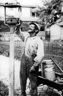
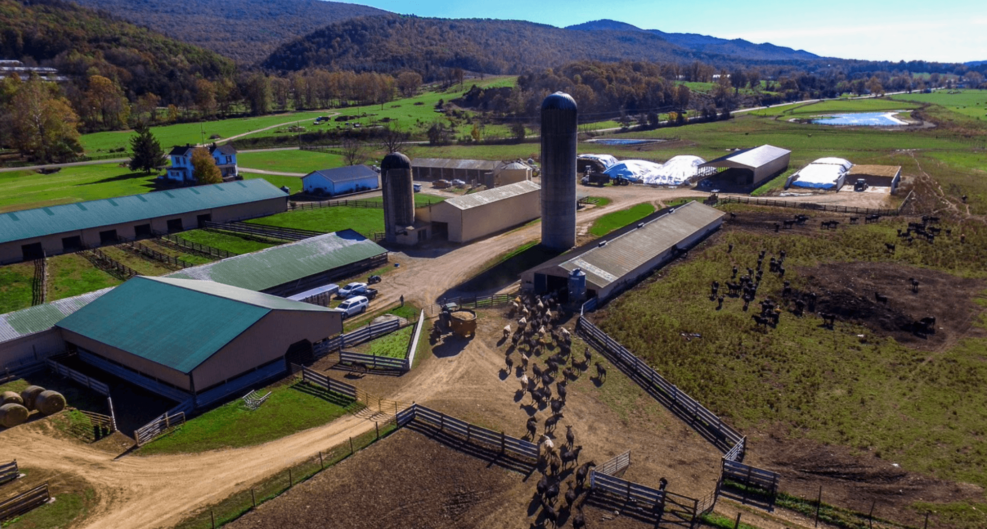
Hardy County’s agriculture & land use is integral to its heritage
- Evidence of permanent settlements made by Native Americans is scant and is currently being researched. It may have been erroneously thought that they were predominantly hunters/gatherers moving through Hardy County rather than living here.
- European settlers arrived in significant numbers during the 2nd quarter of the 1700’s, drawn to the rich farmland. Once established, the farmers drove their livestock to the eastern population areas for sale.
- Today, Hardy County is the No. 1 agricultural producing County in West Virginia
- Often passed down through generations, 97% of the 580 farms in the County (2017) are family owned
- Farmland is now shared with industry, residential development, and outdoor recreation (hunting, fishing, paddling, hiking, mountain biking, and cycling) but our area remains rural
Native Americans in Hardy County
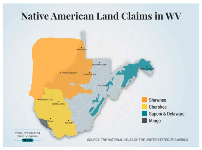 The presence of Native Americans in West Virginia cannot be disputed but identifying where (or if) settlements were located in Hardy County is fundamental to establishing an understanding of our heritage.
The Adena mound builders have been widely researched but, for the most part, the existence of settlements were denied, and Native Americans were primarily identified as transient (i.e., hunters/- gatherers). Obscuring of Native American presence is deeply entwined with WV’s anecdotal history.
Writings such as Kercheval’s 1833 History of the Valley of Virginia is an example of the biased perspective of Hardy County’s early history. It is the randomness and inaccuracies of the available historical literature that will make our research challenging. Identifying and interpreting anecdotal history and comparing it to facts and data will be integral to fully grasping the complexity of our heritage.
Maps will help to tell our story
- Joshua Fry & Peter Jefferson (TJ’s father) produced this map in 1751. Considered one of the most accurate surveys, it was frequently copied. Prior to this, maps were often fanciful and/or boundaries were politically motivated.
- Hampshire County, later divided into four counties including Hardy, appears on the boundary of Virginia’s western frontier.
- Notice the Native American names identifying many of the waterways.
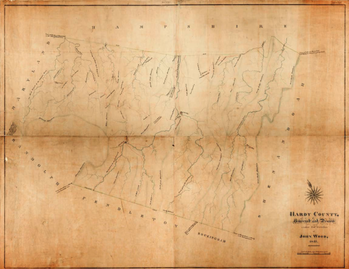
This 1822 map illustrates the population density of Hardy County (before it was separated from Grant). Farms, mills, rivers, roads and the new town of Moorefield (4th oldest town in WV) are depicted in the hand-drawn map produced by John Wood. How does this map inform us about our county today, its current land use compared to 1751 or 1822?
Contemporary GIS mapping and Hardy County Planning Office studies will aid in the interpretation of land use, as well as environmental and population changes in the County over time.
Benefits of the Hardy County Heritage Trails
- Encourages community dialogue, interaction, then engagement
- Provides an interactive educational tool for public and home-schooled students
- Becomes an economic device, energizing the community and increasing the number of visitors to Hardy County
- Creates a platform for cultural, historical, and genealogical research
- Develops an appreciation for the complexity of ‘heritage’ and connects our heritage to that of the world’s
- Offers a broader understanding of our heritage, what factors created it, ways it has been interpreted (or misinterpreted), and how it informs our future
Collaboration is key to successful community projects
While this project was initiated by Hardy County CVB, and joined in partnership with the Hardy County Historical Society, the Hardy County Heritage Trails, with the support of the WVU Fulcrum Project, will ultimately be created by a growing list of community partners including:
- Moorefield Historic Landmark Commission
- Town of Moorefield
- Town of Wardensville
- Hardy County Planning Office
- Lost River Educational Foundation
- Farms Work Wonders/Wardensville Garden Market
- Lost River State Park
- Friends of the Library, Hardy County
- Moorefield Lions Club
- Hardy County WVU Extension Service
- Historic Hampshire
- Hardy County Commission
- …And the residents of Hardy County